Uluṟu-Kata Tjuṯa National Park Adventures
Uluṟu-Kata Tjuṯa National Park is a UNESCO World Heritage Site known for its stunning sandstone formations, rich cultural significance, and striking landscapes in the heart of Australia’s Red Centre.
About Uluṟu-Kata Tjuṯa National Park
Located in the Northern Territory of Australia, Uluṟu-Kata Tjuṯa National Park features two of the most iconic landmarks in the country: the massive sandstone monolith Uluṟu (Ayers Rock) and the group of large, domed rock formations known as Kata Tjuṯa (the Olgas). Spanning over 327,414 acres, the park is a significant cultural site for the Anangu, the local Aboriginal people, offering visitors a chance to learn about their traditions and stories. The park supports a diverse array of flora and fauna, despite its arid environment, with ecosystems ranging from sand dunes to waterholes. The park offers a variety of recreational opportunities, including guided walks, cultural tours, and viewing the mesmerizing change of colors on Uluṟu at sunset or sunrise. The park's natural beauty, spiritual significance, and unique landscapes draw thousands of visitors each year.
Highlights
The awe-inspiring view of Uluṟu during sunrise and sunset.
The cultural insights from the Anangu people through various guided tours.
The panoramic vistas from the Valley of the Winds hike at Kata Tjuṯa.
Exploring the Mutitjulu Waterhole, home to unique wildlife and rich stories.
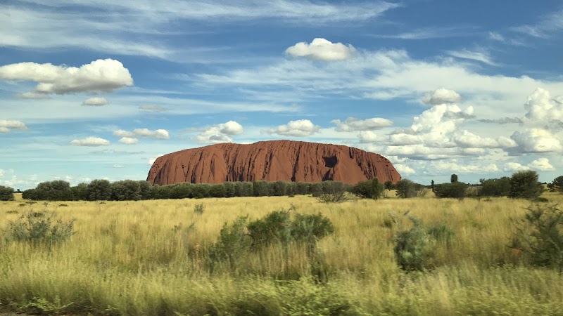
Notable Natural Features
Uluṟu
A massive sandstone monolith standing 1,142 feet high, renowned for its changing colors at different times of the day.
Kata Tjuṯa
A series of 36 domed rock formations known for their unique shapes and cultural significance.
Mutitjulu Waterhole
A permanent waterhole located at the base of Uluṟu, serving as a vital water source and a place steeped in Anangu history.